Photographs by John Wright, staff artist.
SCENES AT ASH HOLLOW
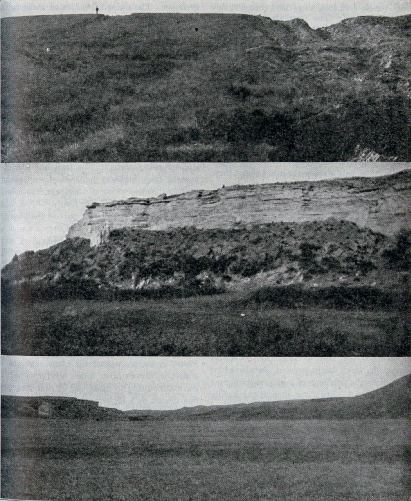
The original route of the Oregon Trail from the south fork to the north fork of the Platte river, by way of Ash Hollow, descends northward from the plain, 3,763 feet above sea level, four miles to the river bottom, at an elevation of 3,314 feet. From the head of the Hollow, the trail, still visible, wound to the left about a mile along the sharp-backed ridges, then dropped by a very steep descent eastward into the Hollow, which here widens into a level valley from a quarter to half a mile wide. The spring, a luxury to the emigrants, still bubbles up strongly a quarter of a mile from the mouth of the Hollow, and at the base of a cliff about 100 feet high, as shown in the middle picture, The cedar and ash trees at one time abundant here all have been cut away. Marks of Fort Grattan, occupied as a post in 1855, are visible near the river north of the east side of the mouth of the Hollow. On the west side of the mouth of the Hollow are the modest gravestones of Rachel Patterson, a girl of nineteen, who died in 1849, and of two infant children.
The figure on the hill is that of Mr. Alberts, editor of the MORTON HISTORY.