MAPS & ATLASES
STATE, COUNTY MAPS & ATLASES
NEGenWeb Project
Resource Center
On-Line Library
MAPS & ATLASES
STATE, COUNTY MAPS & ATLASES
Collection of maps on Old Time Nebraska website - among illustrations from "History and Stories of Nebraska", by Addison Erwin Sheldon, Chicago and Lincoln. The University Publishing Company. 1913 (Produced by C. Snyder)1859 Nebraska map with county lines from NSHS Collections, Vol XIX.
NE Counties over time: 1854 to 1925 - website by Gary Martens.
1872 Map of Nebraska Counties Provided by Pam Rietsch.(large)
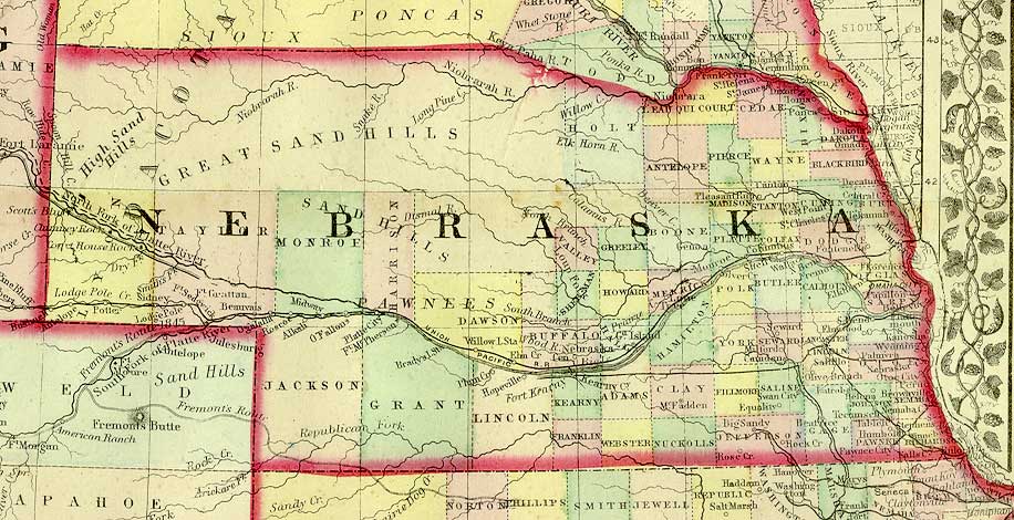
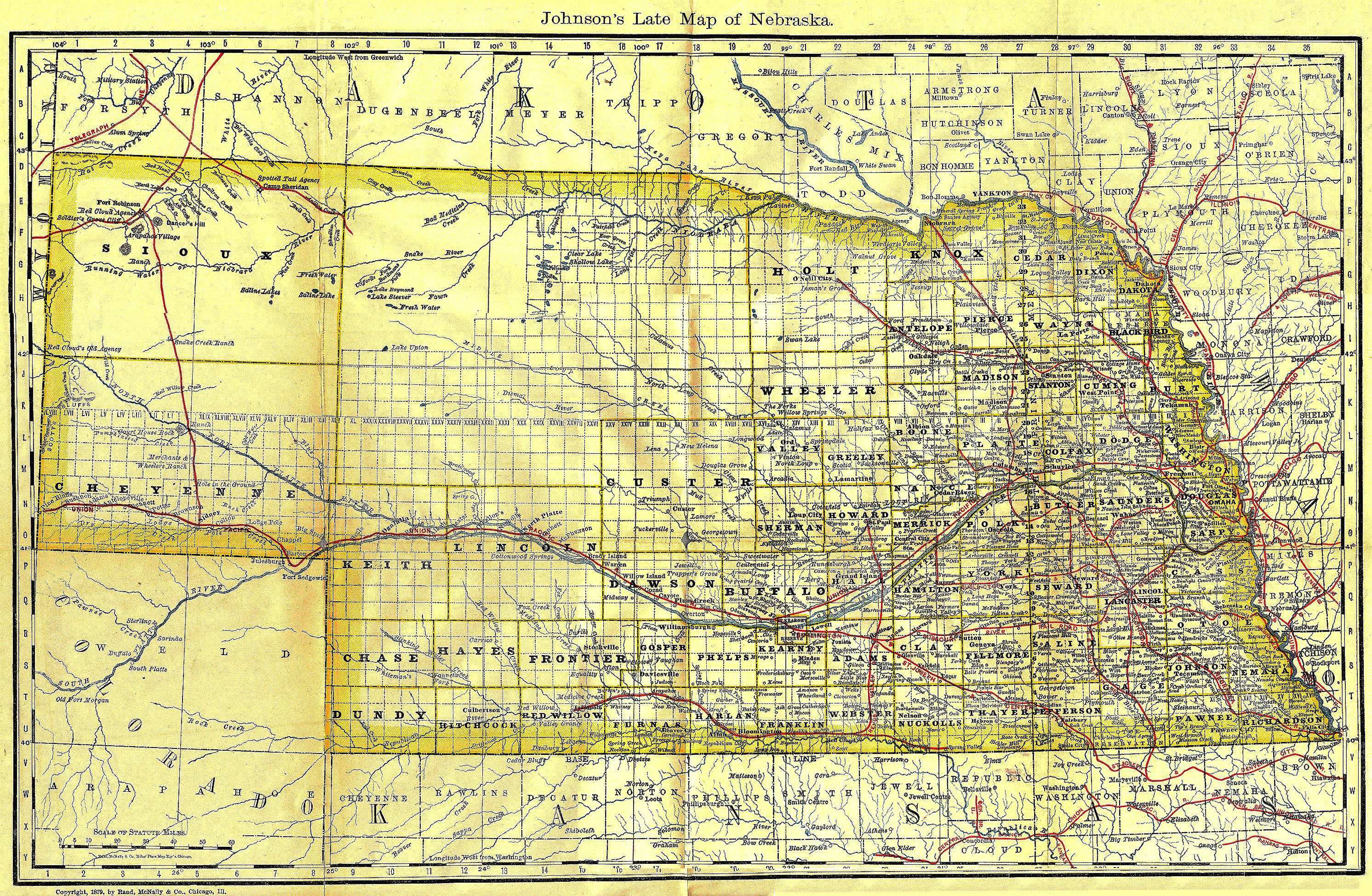
See where they were - Taylor, Harrison, Jackson, and Monroe Counties1879 Map of NE - Map from Johnson's "History of Nebraska"
1882 Map of Nebraska from Andreas History of Nebraska (EKIS website).
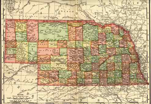
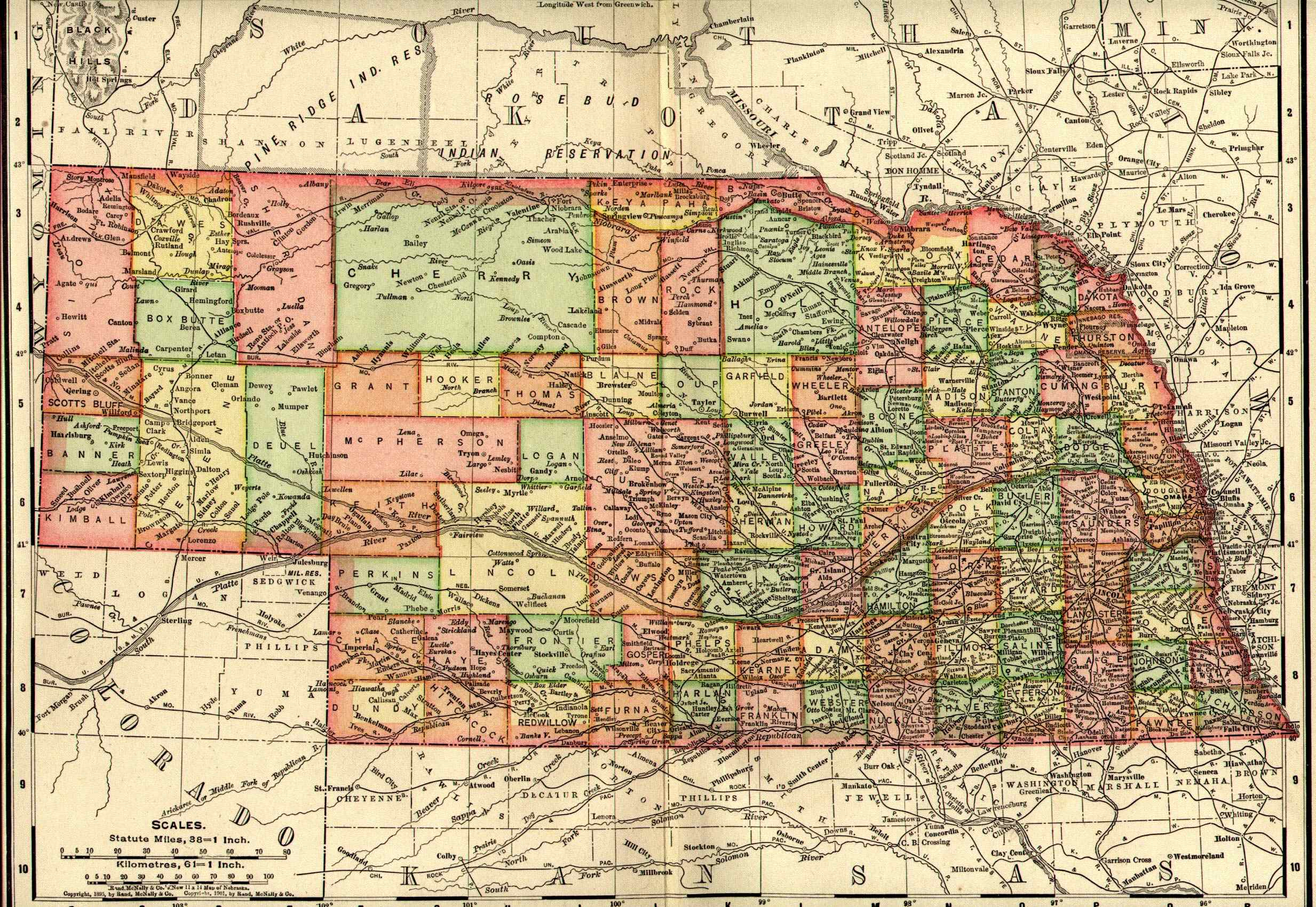
1885 Nebraska Atlas
Maps of the Counties - copied for NEGenWeb Project by Nancy Beach. Thanks. Nancy.
NOTE: Maps only. Text pages will be added at later date.1887 Map of Nebraska - Rand McNally Map from the Chester Oil Co.'s Pocket Atlas of the World, Published by Chester Oil Company, Philadelphia, U.S.A, 1887. Thanks to Connie Snyder.
1895 Map of Nebraska (33kb) - published in the 1904 Encyclopaedia Britannica (image of title page). Scan provided by Danny Brown. (Larger version (738kb)
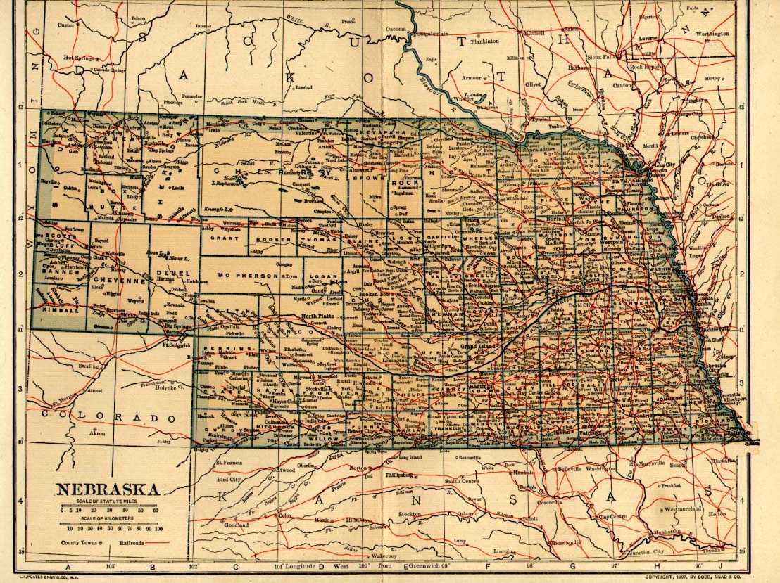
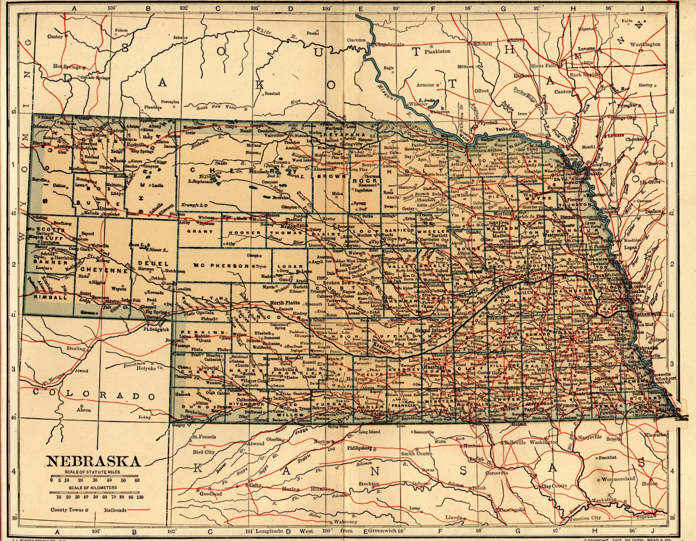
1908 Map of Nebraska (320kb) - Scan provided by Danny Brown, from "The New International Encyclopedia" (image of title page) by Dodd, Mead and Company, New York, NY., 1908. NOTE: Larger version (955 kb) of map now available. Takes a LONG time to load - get yourself a cup of coffee and a snack while waiting. Know you want to read every detail. Thanks to Mr. Brown & C Snyder.
Atlas of Buffalo County, Nebraska, 1919 - Buffalo County website by Mona Houser (maps & owners).
NEW - Atlas of Cass County, 1918 - by Judy Ryden under construction
Dawson County 1904 Plat Book by Connie Snyder, from Dawson website.
Furnas County, 1916 Atlas with plat map of each township, names of owners - Produced by Thomas Corey.
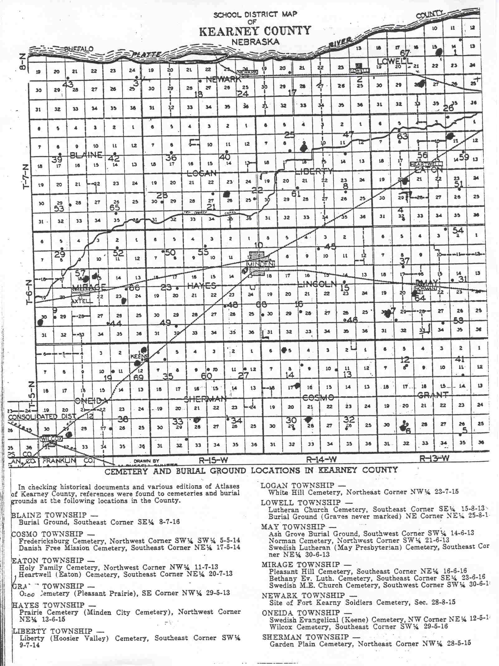
Kearney County - Townships & Cemeteries
Kearney County, NE - 1937 Atlas - Produced by Joy Fisher (Apr 2001, USGenWeb Archives, images and index)Knox County - 1920 Atlas by Tom Risinger
Saline County, 1918 Atlas Index by Doris Peters
Saunders County 1907 Plat Book by Connie Snyder (Saunders website)
Thayer County 1900 Plat Book, by Brenda Busing - maps of townships & lists of owners, from Thayer website.
1895 U.S. Atlas - by Pam Rietsch. atlas.The 1891 Grain Dealers and Shippers Gazetteer by Pam Rietsch - Maps of the Railroad Lines, covering MORE than NE.
1872 County Map of Colorado, Dakota, Indian Nations, Kansas, Montana, Nebraska & Wyoming by Pam Rietsch.
NEW June 2002 - Clay County, 1886 Plat Book
Douglas County, NE - 1937 Plat Book Lots of details, provided by Pam Rietsch.
Merrick County, NE - 1921 Atlas and Plat Book (May 2002)GARDINER'S Atlas of English History (1892) - COMPLETE! 2/19/2000
While the emphasis is on Britain and France, you may want to check the index and view a map for Germany in 1618!
OTHER SOURCES for geographic assistance - NebraskaNebraska Features list from County Unknown (collection of locations - past & present).
Nebraska Place Names, 1925 - University of Nebraska, Lilian Linder Fitzpatrick - Lists of towns & villages in Nebraska by County - Transcribed by Connie Snyder. (May 2001)
Nebraska Counties with date of formation from Marcia Buescher.
List of obsolete County names from NE Records - census page.
List of Nebraska State Historical Markers with text of each one.
Nebraska Dept. of Roads (PDF Files)
Virtual Nebraska - Specializing in space & aerial images for education, project of UNLincoln &UNOmaha.
Land Descriptions - from York County website of Nancy Beach
Land Survey on the Great Plains - an explanation of land terms by Dick Taylor (written for KS, but basics apply to NE)
BEYOND NEBRASKAList - Historical period maps from Goodrich's "History of the United States of America", 1880 (Explorations, Colonies, Early Wars)
List - Historical maps from Montgomery's "Leading Facts of American History", 1920 (Ten are in color)StatsAmerica United States Town/County Database Interactive Search - Finds the county for a town or city you enter.
US Digital Map Library of USGenWeb Project Archives is under construction!
Nebraska maps page has begun!USA - "Historical County Lines" website by John Robertson.
The Library of Congress Map Collections - Panoramic Maps
The panoramic map was a popular cartographic form used to depict U.S. and Canadian cities and towns during the late nineteenth and early twentieth centuries. Known also as bird's-eye views, perspective maps, and aero views, panoramic maps are non-photographic representations of cities portrayed as if viewed from above at an oblique angle. Although not generally drawn to scale, they show street patterns, individual buildings, and major landscape features in perspective.
Home Page Begin Search
From MISSING LINKS, Vol. 7, No. 25, 23 June 2002 http://www.petuniapress.com
The Library of Congress Map Collections - Transportation and CommunicationThe Perry-Castañeda Library Map Collection, University of Texas at Austin - maps for any and all places, historical maps.
Plan to spend a day or more touring this website!TopoZone - topographic maps for the USA (may not help with genealogy, but visit anyway!
The image of the book, feather & maps near the top of this page is from Georgie's Graphics


© 1999-2008 for the NEGenWeb Project by Ted & Carole Miller

